Glowing “Rose Garden” on Catinaccio Hike – Two-Day Photography Fun
Yippie Ki Yay, Mountain Photographers! Are you ready for your next joy hike? Take a Catinaccio trip with us and let’s take advantage of the fact that this is one of the most accessible mountain groups in the Dolomites. Steep scree fields, massive rock faces and pointed needles, hiking and via ferrata excursions, impressive motifs – do we need to say more? Route information, map, photos and trail tips all await you below.
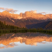
Bright red alpine glow in the last light of the evening sun rays is the trademark of the Rosengarten/Catinaccio (“Rose Garden”). A good handful of alpine refuges make a circumnavigation of this group photographically interesting and sporty.
In the imposingly situated mountain huts, comfort is severely limited, but the views and photo motifs compensate for this immensely. An overnight stay here is a must for real mountain photographers. This tour circles the steep rocky crags and rock faces in a two-day tour.

Route description – this is how your Catinaccio trip looks like on a map
Due to the length of the tour, only the most important way points are described. A hiking map is posted at the Rotwand hut at the latest. Passo Carezza – Rotwand Hut (Rif. Roda di Vael) – Passo Zigolade – Vajolet Hut – (branch off to Gartl Hut and Santner Hut if you feel like) – Grasleiten Pass Hut – Grasleiten Hut – Tschaminschwaige – Weißlahnbad bus stop.
The arrival and return should be explored in advance for this tour. It is best to start this tour in Bolzano and get to the starting point by bus (180). Return from the Weißlahnbad bus stop (bus 185) to Bolzano. Alternatively from the Passo Carezza, you can ascend past the Kölner Hut via a via ferrata along the west side of the Rosengarten massif via the Santner via ferrata to the Santner Pass Hut.
Many via ferrata climbers prefer this ascent and go from here eastwards along the described ascent route back to the Passo Carezza/Karer Pass.

Photo tips that will make your Instagram pop – Rosengarten rock, mountain lake, and minimum light pollution
This tour lives from its possibilities and the overnight stay in one of the mountain huts. We find the massively sloping Rosengarten rock face at the Santner pass hut impressive (tip: ultra-wide-angle lens). The small mountain lake at the Gartl hut and the Vajolet towers hanging behind it are for many photographers.
Likewise a gladly photographed highlight. Monumentally framed between the rock massifs is also the Grasleiten hut.
It is well worth a photo on the descent in the clear morning air (tip: taste fresh goat’s milk!). If you spend the night at one of the huts, you should definitely also try a night shoot – the steep rock faces shield the light pollution of the valleys well.

Mountain Moments Photo Workshops provide Photo Tours for everybody, Alpine Experience for beginners and intermediate-level photographers with 3 to 6-hour routes, as well as Summit Experience for more advanced photographers and hikers. We have private workshops and group classes.


More information about your 2-day Catinaccio adventure in the Dolomites
How to get there by public transport: By bus or train to Bolzano. With bus 180 (bus stop directly in front of the station entrance) direction Fassa Valley to Passo Carezza (bus stop is directly at the top of the pass).
How to get there by car: Brenner freeway to exit Bozen Nord, SS241 direction Welschnofen/Karerpass (Passo Costalunga). Parking directly at the pass. Return by bus 185 via Bolzano or via Niger Pass (bus 176 to S. Cipriano, continue with bus 185 to the Niger Pass intersection). From here a few minutes on foot or with bus 180 to the top of the pass.
Hike difficulty level: medium – difficult
Start/finish: Passo Carezza/Passo Costalunga (coordinates: geogr. 46.404563,11.608319)
Duration/distance: 9h, 21km
Ascent/descent: 1295m/1885m
Highest point/lowest point: 2601m/1185m
Special dangers: in 2020 the path to Passo delle Zigolade was closed due to the danger of falling rocks. The alternative and easier route is via Ciampiec (cable car station from Pero di Fassa) and Gardeccia hut.
Meals: Gardeccia hut, Preuss hut, Grassleiten pass hut, Grassleiten hut Tschaminschweige.
Tips: Instead of descending to Weißlahnbad, you can also extend in another day stage via Tierser Alpl/Schlern/Seiser Alm to Seis am Schlern.
The most beautiful photo spots and hikes in the Dolomites – experience this hiking tour and 29 other exceptional trips in the Dolomites now.
 Fancy more hikes in the mountains – and beautiful photos? Get out into nature! Experience the best hikes and locations with our new book: Alps – Photo and Hiking Guide. The 90 best Photo Locations and 30 most panoramic Hikes.
Here we have compiled the most beautiful locations and photo opportunities. 30 hikes with 90 photo spots are selected and described in such a way that you can easily experience these wonderful landscapes for yourself – including GPS tracks and hiking map and all other information.
You can take a closer look at the ebook here– – why not give it as a gift to someone you want to visit and photograph these places with!
Of course, you will find all the information about this hike in the ebook. After registering, you will also receive the GPS track, so you are on the safe side and won’t get lost and will find all photo locations easily.

Hi, i am Marius, i love exploring the mountains and nature. Friends say, i know the mountains better than most locals, but actually i get lost all the time while photographing ;). Read more about the Mountain Moments Team.


