
Great Ski Tour near Innsbruck: Senders Valley/Gamskogel – Double the Downhill fun
Great ski tour near Innsbruck and Axamer Lizum: Double your downhill fun including a bus ride and gondola ride and enjoy north facing powder on this medium difficult ski tour into Senders Valley. See the map, images, and photography tips and tricks below, and join us on our next adventure.
Innsbruck just keeps on giving, and nobody is left behind, not hikers, mountain bikers, or winter sports fans. While the camera is universally on the list of equipment a nature lover should bring, the rest depends on the terrain. This time, prepare multiple layers of your skiing clothes, headwear, eyewear, gloves, and skies because we are going to Senders Valley. See the map, images, and photography tips and tricks below, and join us on our next adventure.
The Senderstal (Senders Valley) is a true paradise for downhill ski tourers. After a nice first “gift” descent after the ascent in the ski area, you dive into a quiet valley. Whether it’s the easy but downhill exciting ski tour to the Gamskogel, the Angerbergkopf or into one of the steep gullies in the Kalkkögeln – here every ski tourer will find a suitable variant and often good snow. The variants all meet for a well-deserved break at the idyllically situated Kemater Alm(hut). Back to town life is easy by toboggan run and bus.
Directions! This is how your Senders Valley adventure looks like on a map
Downhill
From Hoadl along the slope to the Hoadlsattel (2264m). Here (you can traverse or ascend to the left or right for a while, as you wish) descend to the west on the moderately steep slope towards the Kemater Alm. The terrain is wide and offers many possibilities. However, some variants end in very dense forest or brushwood. Therefore, it is better to follow the obvious gullies to the visible Kemater Alm.
Ascent
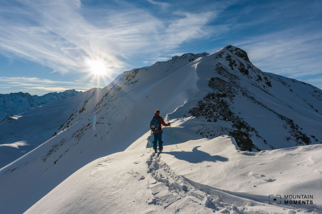
Slightly above the Kemater Alm at about 1800m and follow the path uphill to the Adolf Pichler Hut (1977m). From here, always follow the course of the flat valley logically south. Depending on snow conditions, sooner or later climb the slope a little to the left logically to the Seejöchl saddle (2518m). Here now follow the ridge southwest to the summit of Gamskogel (2659m).

Descent
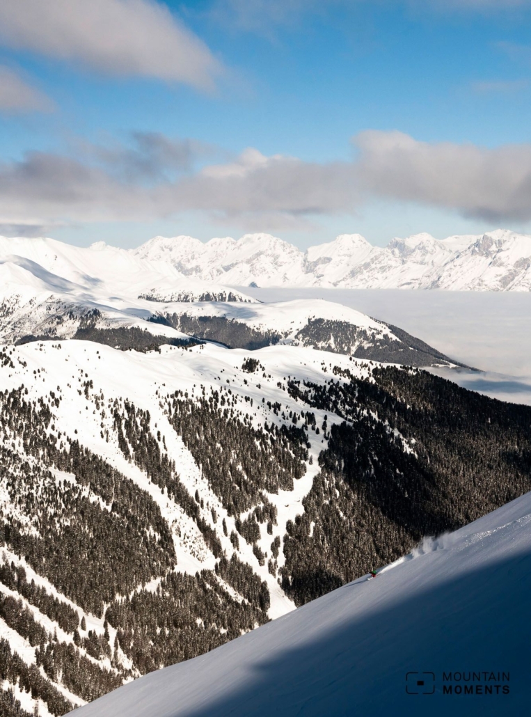
From the summit, descend the north slope at a suitable point and follow the slope slightly to the left until you reach the Sendersbach. Keep slightly to the right of the course of the valley to take the momentum with you. Along the path to the right of the stream back to the Kemater Alm. From here take the toboggan run to Grinzens and, if the snow conditions are good, continue almost to the bus stop. Take the bus back to Innsbruck.

Photo tips that will make your Instagram pop – the view from Gamskogel and the Kemater Alm
Besides the viewpoint directly at Hoadl, the view from Gamskogel and the Kemater Alm are the most beautiful photo points.

Mountain Moments Photo Workshops provide Photo Tours for everybody, Alpine Experience for beginners and intermediate-level photographers with 3 to 6-hour routes, as well as Summit Experience for more advanced photographers and hikers. We have private workshops and group classes.
More information about your skiing trip in the Austrian Alps
How to get there by public transport: by bus L1 or L2 from Innsbruck center to Axamer Lizum ski area.
Difficulty level: easy-medium
Duration/distance: 5h/17km
Ascent/descent: 940m/2315m
Highest/lowest point: 2659m/960m
Refreshment stop: Kemater Alm
Start/finish: Hoadl mountain station (coordinates: geogr. 47.182957,11.281500)
Best time: Jan-Apr
Tips: Buy a single ascent with the Olympiabahn.
Special hazards: When ascending, watch out for steep slopes in the Kalkkögeln and their potential avalanche runout zones.
The best Winter Adventures in and around Innsbruck – Skiing, Freeride, Skitour and more

Fancy more Winter adventures in Tyrol and around Innsbruck? We got you covered! The best outdoor sports activities for Winter enthusiasts as eBook: Innsbruck Winter Outdoor Guide.
Here we have compiled the most beautiful locations and photo opportunities. 30 activities with numerous photo spots are selected and described in such a way that you can easily experience these wonderful adventures around Innsbruck for yourself – including track infos, and maps and all other information that you need.
You can take a closer look at the Innsbruck ebook here– – why not share it with your adventure partner in crime?

Hi, i am Marius, i love exploring the mountains and nature. Friends say, i know the mountains better than most locals, but actually i get lost all the time while photographing ;). Read more about the Mountain Moments Team.


