
Skitour Zuckerhütl – The most famous high-alpine tour in Stubai Valley next to Innsbruck
Get ready for a cold hike with contradicting heart-melting views on a mountain in Tyrol (Austria). What German alpinist Joseph Anton Specht first witnessed mid 19 century, is very much available for any hiker that is skillful with the skies on. Get to know the ascend and descend of this 14-kilometer route on your computer/phone screen before you you join us in person. We give you map, route descriptions, and photography tips and tricks.
The Zuckerhütl used to be the epitome of a perfect firn horn. The Zuckerhütl still has the pointed hat shape today. However, the “sugar” – that is, the often snowed-in glacier ice – has melted away more and more over the years. Now it rises from the no longer quite eternal ice as a climbable highest mountain (3507m) in the Stubai Alps from the ice of the Sulzenauferner.
The Zuckerhütl is often visited in summer and winter. The nearby ski area significantly shortens the climb to the highest point of the Stubai Alps. The classic downhill route back to the ski area is relatively easy and, thanks to the high starting and finishing point at the ski area lifts, often possible early or even very late in the season.
The described descent over the Sulzenauferner is moderately difficult and especially scenically much more attractive.
The extensive Sulzenauferner (beware of crevasses!) invites you to large, rapid downhill turns. Further into the valley, the descent along narrow trails and plateaus is somewhat more varied and adventurous

Route description! This is how your Zuckerhütl skiing/hiking adventure looks like on a map
Ascent
The starting point is the Joch between Gaiskar- and Windacher Ferner, which can be reached by gondola from the Eisgrat. From here you first traverse above the snow park a bit to the south and then descend through variant terrain to the east. At the height of the valley station of the Gaiskarferner T-bar lift, the terrain narrows somewhat. After a short gully, you ski a bit flat to the southwest into the hollow below the Pfaffenferner. Here the skins are put on. The ascent is best done first along the southern edge of the glacier tongue.
After a short, steeper passage, it goes in a long, flat straight line to the northeast to the Pfaffenjoch. If the snow conditions are good, it is also possible to ascend the glacier crosswise along the summer trail. However, this is usually the more arduous option. After crossing the Joch, you cross the upper part of the Sulzenauferner, pass the north face of the Zuckerhütl and ascend to the Pfaffensattel (3332m) between Zuckerhütl (3507m) and Wildem Pfaff (3456m). From there, head west towards the summit.
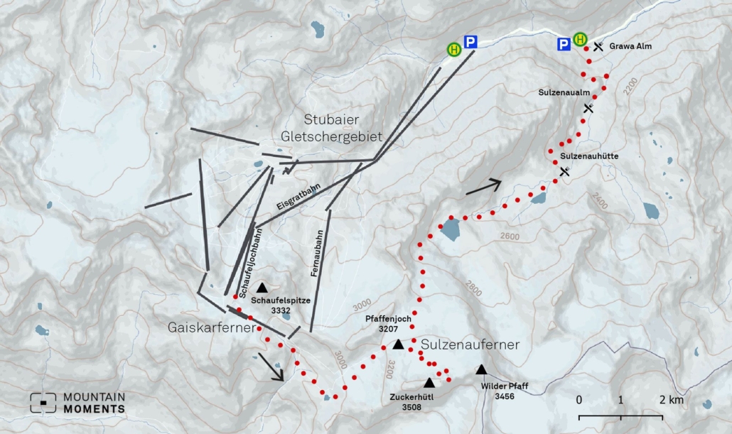
Descent
Of course, it is possible to ski down along the ascent route, in which case there is still a short counter ascent back to the ski area. This variant is recommended especially very early or very late in the season. More interesting, however, is the descent via the Sulzenauferner down into the Stubaital. To do this, descend northwards via the Sulzenauferner (caution: crevasses). It is best to first follow the ascent route on the western side of the glacier and far from the Aperen Pfaffengrat.
Over several short steep steps and past impressive crevasse zones you soon reach a very flat area directly below the glacier. Here continue northeast until after another short steep step you enter again a very flat valley. Follow this to the northeast until you reach the Sulzenauhütte (2191m). Here cross a bit to skiers’ left or northwest past the material cable car and descend through steep, unclear terrain towards Sulzenaualm. Mostly there are traces, nevertheless, a good orientation ability is required here.
Continue flat to the northeast, past the alpine pasture buildings and on a narrow hiking trail first to the northeast, then to the west. This part can be unpleasant once again if the snow is hard and rutted. Soon you reach a forest aisle that leads directly to the stream immediately below the Grawa Alm. If there are no suitable snow bridges, you will find a wooden bridge a few meters rider’s left of the cut. Return to Innsbruck by bus, the bus stop is located directly above the Grawa Alm.
Photo tips that will make your Instagram pop – the summit cross on the Zuckerhütl
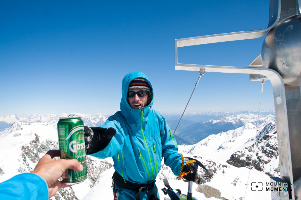
Every Innsbrucker must have shot a picture with the summit cross on the Zuckerhütl felt once in his life. The rocky final ascent is also worth a snapshot if you stand safely and find a free hand for the photo camera.
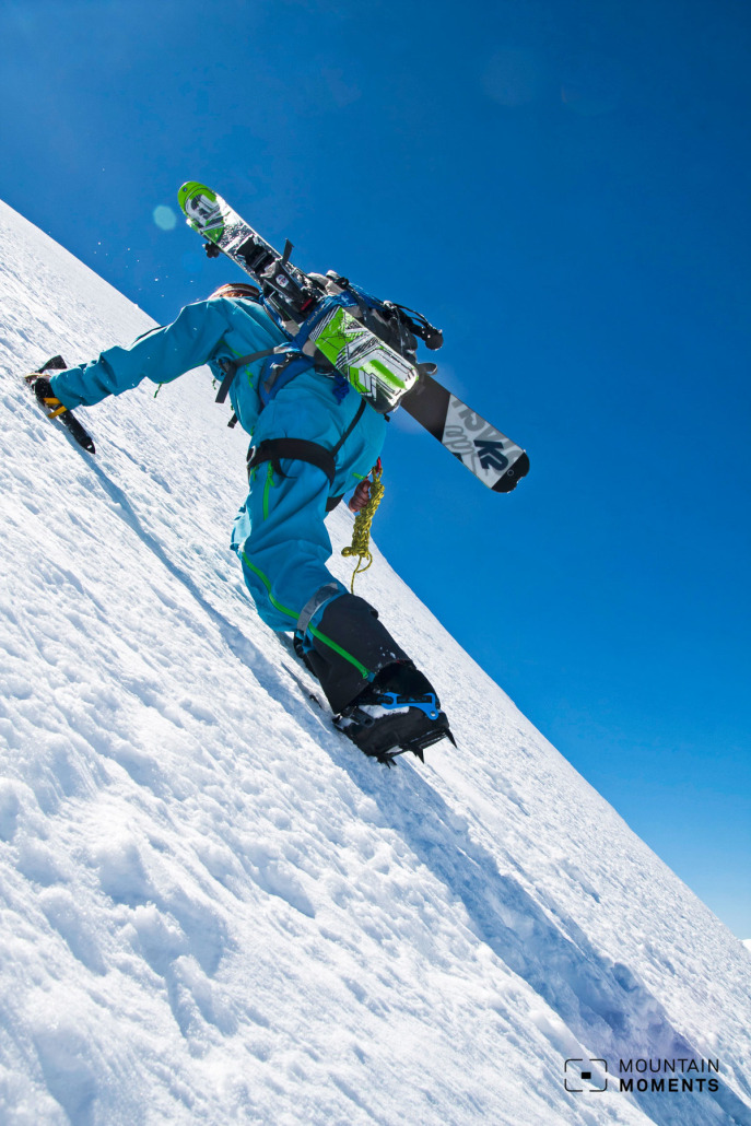
On the descent, the wide expanse of the Sulzenauferner provides a nice photo area with views almost all the way to Innsbruck.

More information about your snowy expedition – hike difficulty level, duration, distance and more!
Arrival:
How to get there by public transport: by bus 590 from Innsbruck center to Stubai Glacier. Return from the Grawa Alm bus stop.
Difficulty level: medium
Duration/distance: 6h/ 14km
Ascent/descent: 800hm/2300hm
Highest/lowest point: 3507m/1530m
Refreshment stop: –
Start/finish: Stubai Glacier Cableway, top station Schaufeljochbahn (coordinates: geogr. 46.977032,11.110654)
Best time: Dec-May
Tips: Reduced tour ticket (one-time ascent) available. Other worthwhile touring destinations include Pfaffensattel and Wilder Pfaff.
Special dangers: Glacier crevasses, the danger of falling.
The best Winter Adventures in and around Innsbruck – Skiing, Freeride, Skitour and more

Fancy more Winter adventures in Tyrol and around Innsbruck? We got you covered! The best outdoor sports activities for Winter enthusiasts as eBook: Innsbruck Winter Outdoor Guide.
Here we have compiled the most beautiful locations and photo opportunities. 30 activities with numerous photo spots are selected and described in such a way that you can easily experience these wonderful adventures around Innsbruck for yourself – including track infos, and maps and all other information that you need.
You can take a closer look at the Innsbruck ebook here– – why not share it with your adventure partner in crime?

Hi, i am Marius, i love exploring the mountains and nature. Friends say, i know the mountains better than most locals, but actually i get lost all the time while photographing ;). Read more about the Mountain Moments Team.


