Hiking to Kehlstein House! Panoramic Photography as Rossfeld Scenic Road and Dark History of the “Eagle’s Nest”
Experience a lesser known hike at Kehlstein House / Eagle’s Nest away from the crowds. The easy to reach summit of the Kehlstein will not only give you eye pleasure with beautiful views of the Salzach Valley and Berchtesgaden… This trip in southeastern Germany also doubles as a history class, and even less experienced hikers can take part in it! Options for experienced hikers: challenge yourself in a demanding Via Ferrata.
Mountain Moments is here to share with fellow hiking enthusiasts all the information necessary to make the most of the day in the Alps, and this includes a map and comprehensive but easy-to-understand photography workshops, as well.
Learn about the history of this location while enjoying the outdoors
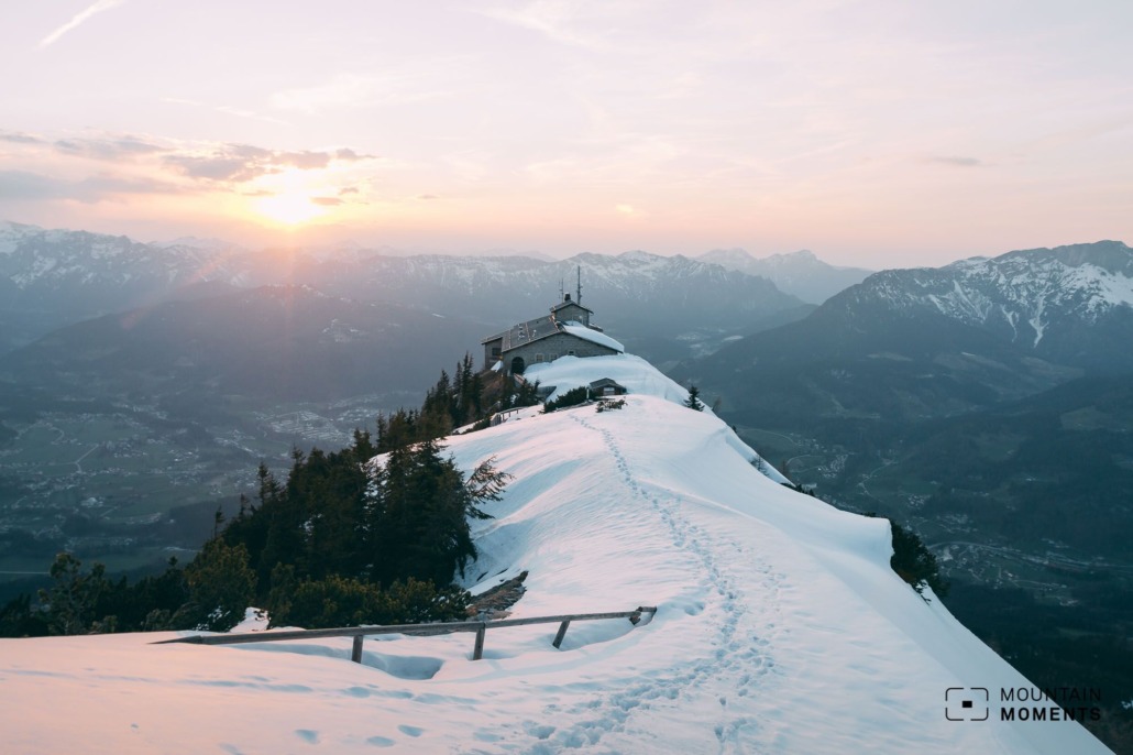
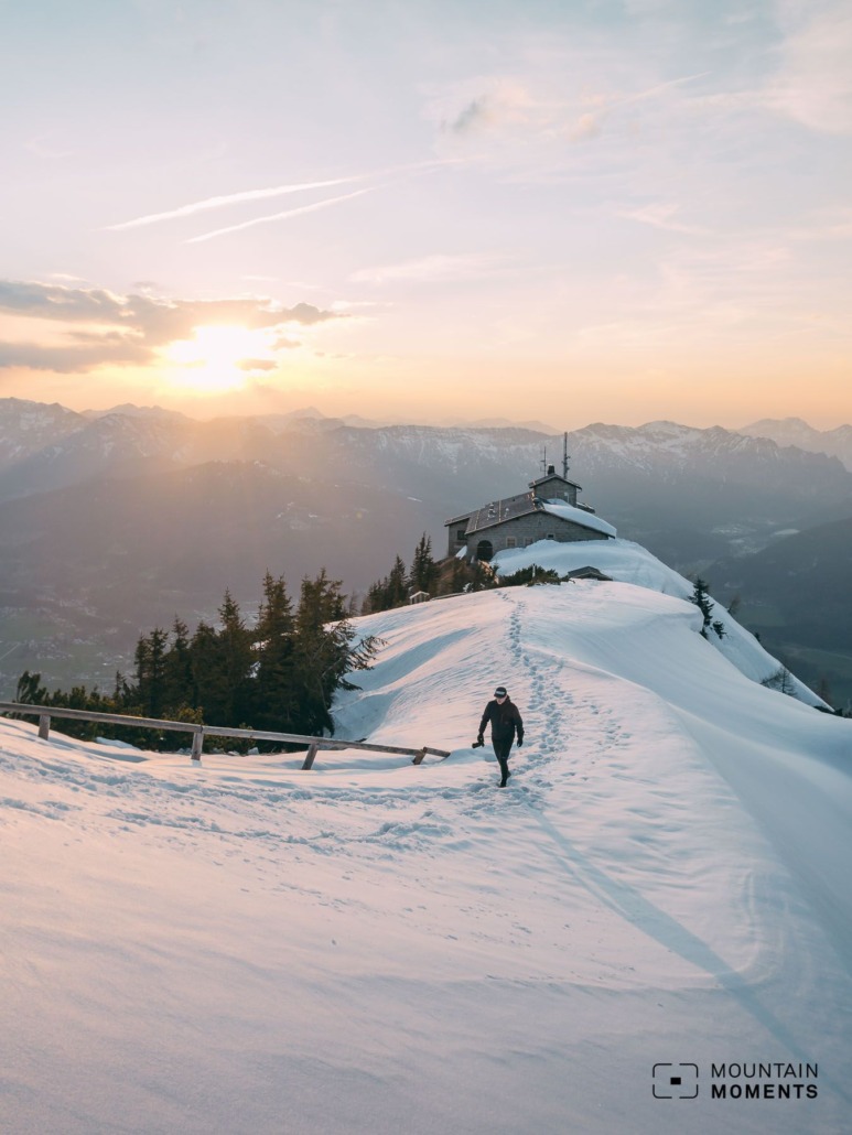
Experience history up close. During National Socialism, the Kehlstein Haus was part of the Obersalzberg restricted area. Also called the Eagle’s Nest by the Allies, the Kehlstein Haus (built in 1938) can be viewed in its original condition.
The former second seat of government of the National Socialists is now used as a mountain restaurant and excursion destination. Anyone interested in coming to terms with the Nazi dictatorship will find excellently prepared information here. But the panoramic view is also impressive from here.
The hike described here is quite easy; locals like to do it as an after-work lap at sunset. Difficult additional options provide the Alpine flavor for experienced mountaineers.
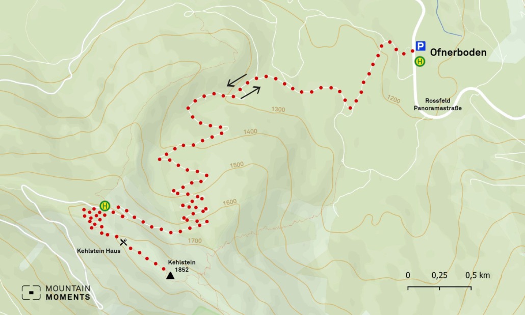
Directions! This is how your hiking adventure looks like on a map
The starting point of this tour is the Ofnerboden car park (1150m) on the Rossfeld Panorama Road.
It goes immediately right into the forest in the direction of Kehlstein Haus. The Dalsenwinkelweg leads continuously through the forest, climbs steeply and finally leads logically to the Kehlstein Haus car park. Here we follow the signs uphill to the Kehlsteinhaus.
The summit cross of the Kehlstein (1852 m) is only a few meters away.
Particularly ambitious mountaineers can also climb the Hoher Göll from the Mannlgrat. Anyway, the view up here is worth the effort.
Alternative
Those who are used to using their hands when hiking in the mountains can still connect the Mannlgrat to the ascent after the summit cross (via Ferrata: no fear of heights and sure-footedness required). The path leads downhill via a steep, difficult path (Gölleiten, Purtschellerhaus, 1681m) back to the panoramic road.
Photo tips that will make your Instagram pop! Don’t forget the telephoto lens
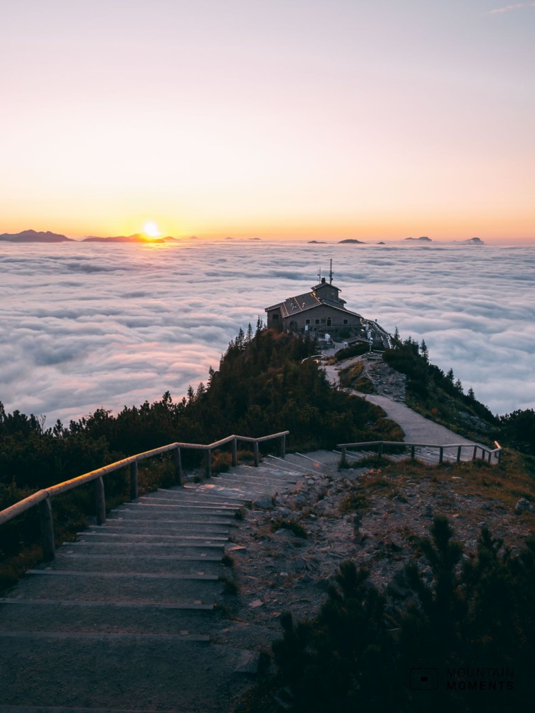
We have the best photographic view from the Kehlstein summit. Here the ridge with the Kehlsteinhaus acts as a visual element.
Mountain Moments Photo Workshops provide Photo Tours for everybody, Alpine Experience for beginners and intermediate-level photographers with 3 to 6-hour routes, as well as Summit Experience for more advanced photographers and hikers. We have private workshops and group classes.
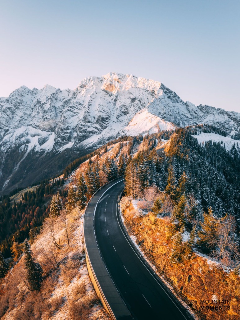
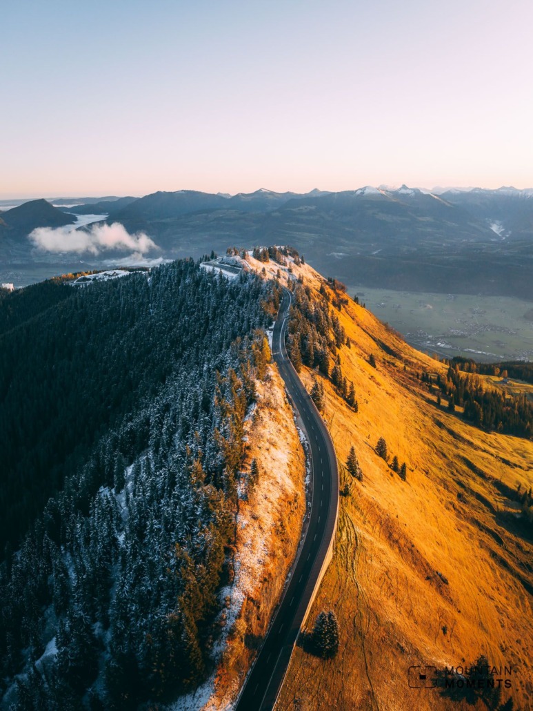
In addition, the panoramic road also offers an exciting perspective: the striking east flank of the Hoher Göll is just as impressive as the many deep views of the Salzach Valley, the Berchtesgaden Alps, and the Tennengebirge. Don’t forget the telephoto lens!
More information about your hiking adventure – from arrival to the finish line
Arrival: B319 to Berchtesgaden, towards Obersalzberg and Rossfeld Hochalpenstraße, Ofnerboden car park (1150m).
Public transport: By train to Berchtesgaden and bus 838 to Documentation Obersalzberg and start the hike here (approx. 25 minutes).
Difficulty: easy – medium
Duration: 3.5 hours, 11.5 km
Ascent/descent: 705hm/705hm
Highest/lowest point: 1881m/1164m
Start/finish: Ofnerboden car park, Rossfeld – Panoramastrasse (coordinates: geogr. 47.620455, 13.063130)
Particular dangers: For Mannlgrat and Hoher Göll: sure-footedness and a head for heights are necessary. Via Ferrata set recommended for both.
Tips: Be sure to include a visit to the Obersalzberg documentation.
The most beautiful photo spots and hikes in the German Alps – experience this hiking tour and 29 other exceptional regions now.

Fancy more hikes in the mountains – and beautiful photos? Get out into nature! Experience the best hikes and locations with our new book: German Alps – Photo and Hiking Guide. The 90 best Photo Locations and 30 most panoramic Hikes.
Here we have compiled the most beautiful locations and photo opportunities. 30 hikes with 90 photo spots are selected and described in such a way that you can easily experience these wonderful landscapes in Bavaria for yourself – including GPS tracks and hiking map and all other information.
You can take a closer look at the ebook here– – why not give it as a gift to someone you want to visit and photograph these places with!
Of course, you will find all the information about this hike in the ebook. You als get the GPS track of this trail, so you are on the safe side and won’t get lost and will find all photo locations easily.
Feel invited to comment when you have finished this hike, thanks.

Hi, i am Marius, i love exploring the mountains and nature. Friends say, i know the mountains better than most locals, but actually i get lost all the time while photographing ;). Read more about the Mountain Moments Team.


