Brunnstein Hiking Tips! Exciting Photo-Friendly Tour in the Mangfall Mountains
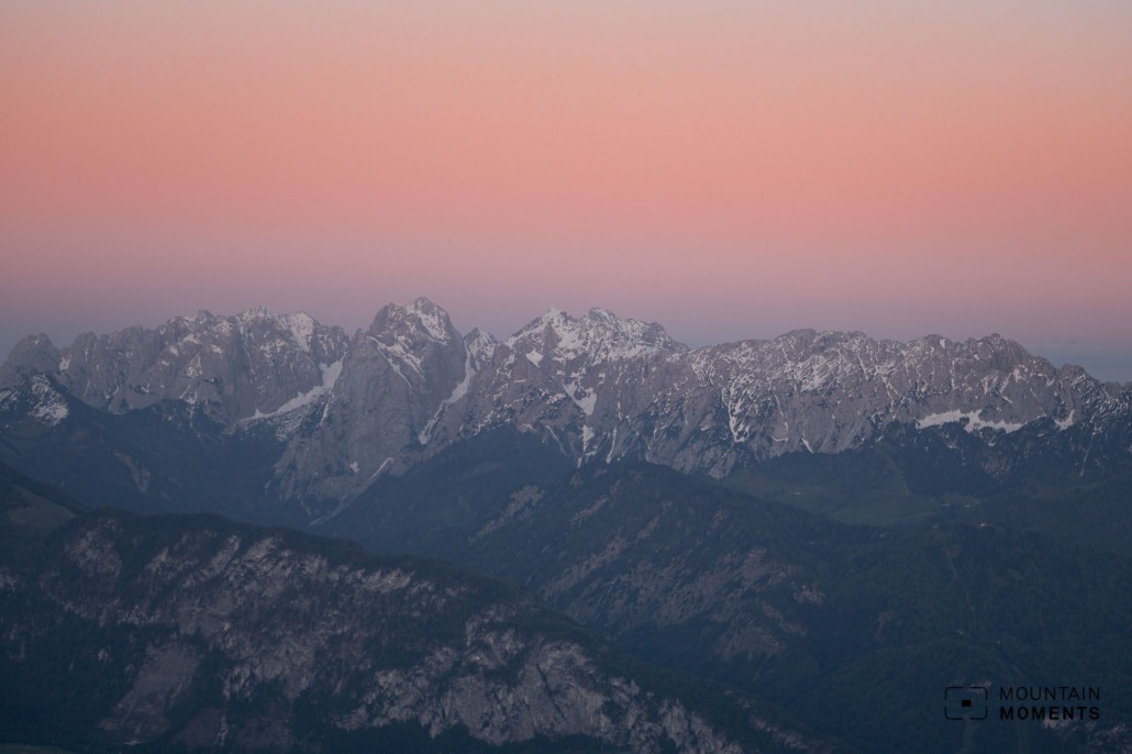
Mangfall Mountains, surrounded by Isar Valley (west), the Inn Valley (east), and Brandenberg Alps (south), provide a versatile and exciting hiking experience and premium photography opportunities.
Here on Mountain Moments, we give you detailed directions and a hiking map, valuable advice that comes from years of experience in hiking and photography, as well as professional tips to get the most from your camera.
What to expect when hiking in the Mangfall Mountains?
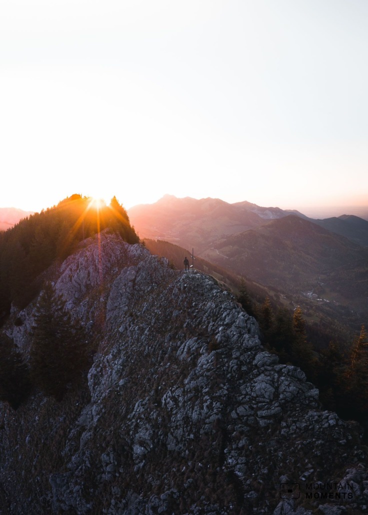
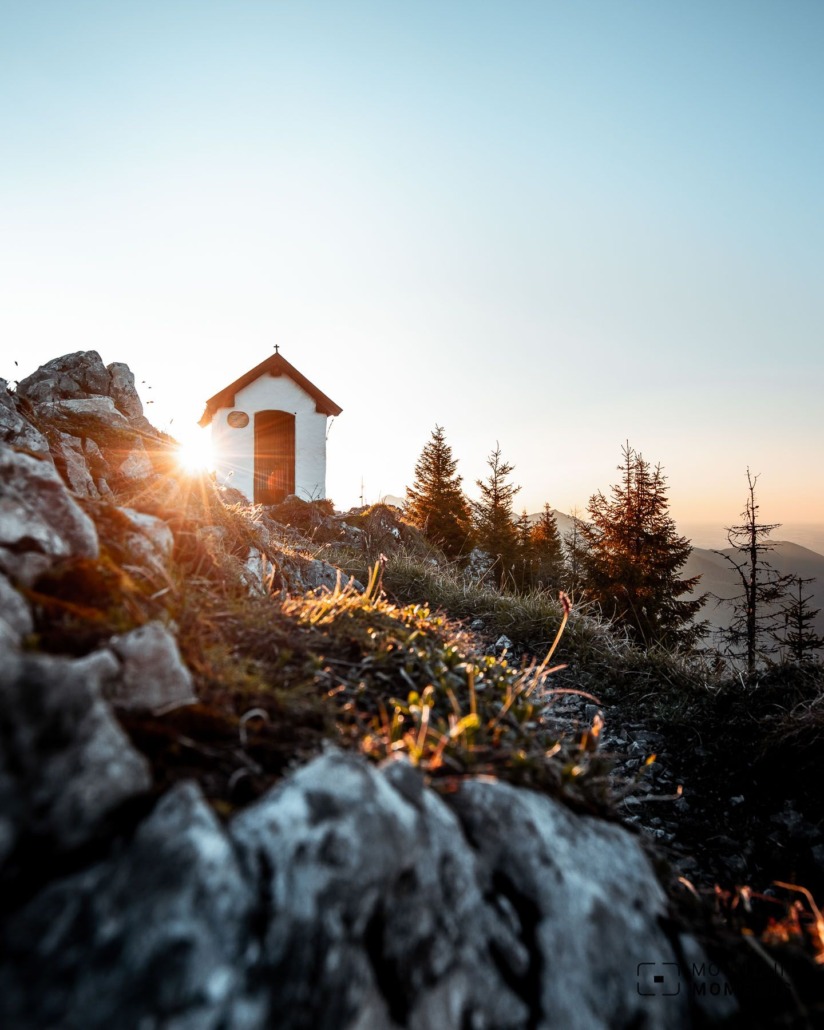
The mountain tour on the Brunnstein is varied. The sporty summit ascent inspires the mountain hikers on this exciting trail, while a small chapel attracts hikers and photographers alike.
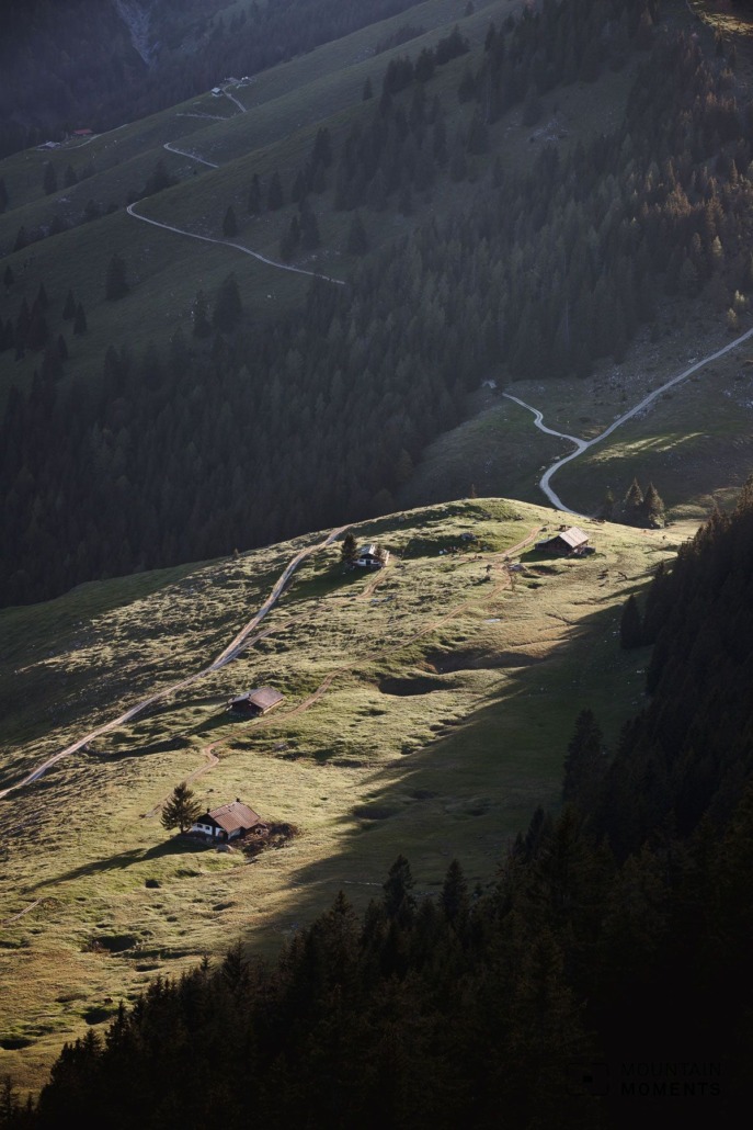
The scattered alpine meadows and clearings with the romantic alpine huts are an attractive contrast to the rocky climb. Here, the hikers climb short ladders and walk through a crevice.
Directions! This is how you hiking adventure looks like on a map!
The starting point is at the Gasthof Tatzelwurm car park (755m). Here, take path no. 657 in the direction of Schoißer Alm (940m), slightly uphill to a clearing. Here turn right in the direction of Brünnsteinhaus. Continue up a narrow, steep mountain path in serpentines, past a clearing and a rock step secured with ropes through meadows and forests to the Brünnsteinhaus (1342m).
Here is the decision: do you climb the summit with the chapel via the short via Ferrata (A/B) – here the hike goes through a narrow crevice and over ladders – or is it better to walk around the Brünnstein on the hiking trail? If you take this route, you can also descend to the Brünnstein (1619m) via the normal route.

Downhill, both path variants meet and we go to the idyllically situated Himmelmoos Alm. Here we briefly follow road no. 651 downhill to a small hut and climb to a saddle (1440m) in a westerly direction. Follow the signs for the Seelacher Alm.
Now we go downhill over pastures to the Seelacher Alm (1320m) and downhill on a road until we meet the ascent path above the Schoißer Alm (940m) again. Here we return to the starting point on the known route.
Photo tips that will make your Instagram pop! Romantic Alpine huts and breathtaking views
The roaring waterfalls on the Tatzelwurm are particularly well known on this tour – they offer a good photo alternative, especially in bad weather.
Mountain Moments Photo Workshops provide Photo Tours for everybody, Alpine Experience for beginners and intermediate-level photographers with 3 to 6-hour routes, as well as Summit Experience for more advanced photographers and hikers. We have private workshops and group classes.
In the course of the tour, we discover some traditional and romantically situated Alpine huts as well as clearings that offer wonderful views.
Information you should know before you go hiking in Brunnstein – from arrival to the finish line
Getting there: From Munich A8, exit Brannenburg and take the toll road to Tatzelwurm (car park).
Public transport: May to November: by train from Munich via Rosenheim to Oberaudorf. Change to the Wendelstein ring line (bus) to the Tatzelwurm stop (LINK).
Difficulty: medium – difficult
Duration: 5.5 hours
Distance: 15km
Ascent/descent: 1045hm/1045hm
Highest/lowest point: 1619m/755m
Refreshments available: Tatzelwurm mountain inn, Brünnsteinhaus , Seelacher Alm, Schoißer Alm
Start/finish: parking lot/Tatzelwurm stop (coordinates: geogr. 47.672201, 12.084712)
Particular dangers: –
Tips: To go directly to the Tatzelwurm waterfall, use the lower parking lot.
The most beautiful photo spots and hikes in the German Alps – experience this hiking tour and 29 other exceptional regions now.

Fancy more hikes in the mountains – and beautiful photos? Get out into nature! Experience the best hikes and locations with our new book: German Alps – Photo and Hiking Guide. The 90 best Photo Locations and 30 most panoramic Hikes.
Here we have compiled the most beautiful locations and photo opportunities. 30 hikes with 90 photo spots are selected and described in such a way that you can easily experience these wonderful landscapes in Bavaria for yourself – including GPS tracks and hiking map and all other information.
You can take a closer look at the ebook here– – why not give it as as fit to your hiking partner in crime?

Hi, i am Marius, i love exploring the mountains and nature. Friends say, i know the mountains better than most locals, but actually i get lost all the time while photographing ;). Read more about the Mountain Moments Team.


