Sunrise Tour in Innsbruck: Catch the First Rays on Serles Hike
Locals favourite sunrise hike near Innsbruck: Demanding Hike to Serles has it all. Get all infos for this hike including map and photo tips on this blog.
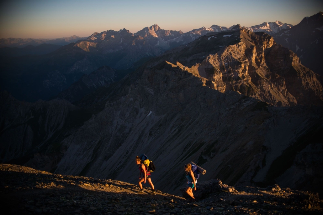
Steep uphill trails, gravelly terrain, 1100-meter ascent and descent – all of this will become a faint memory when you finally come across the sought-after sights on this challenging hike in the Austrian Alps. Once the goal has been accomplished, the effort put in is placed in the “worthwhile” folder, and then the photographer in you kicks in. Join Mountain Moments on this Innsbruck outdoor adventure, enjoy the rich nature and catch your own early sun rays.
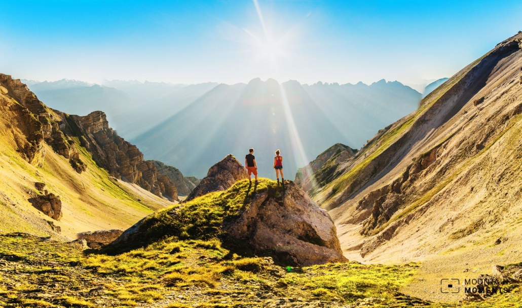
A bit like the Matterhorn above Switzerland, the Serles towers over Innsbruck. It is the queen of Innsbruck’s mountains, the dominant mountain when you look at the city from the Nordkette. The queen hike is quite demanding, but the view from the steep summit plateau is at least worth the effort.
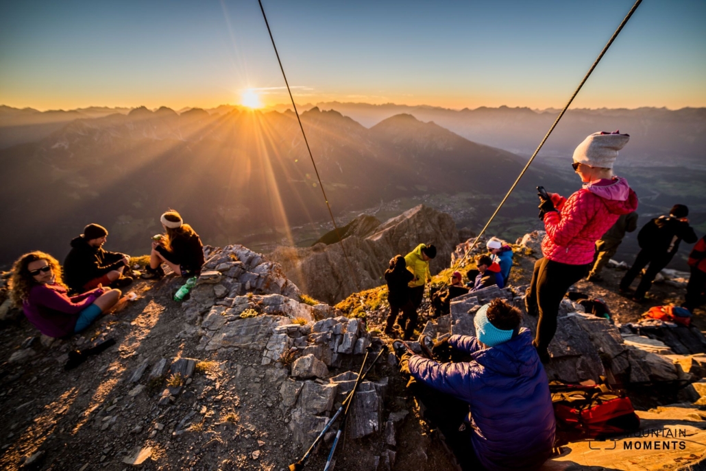
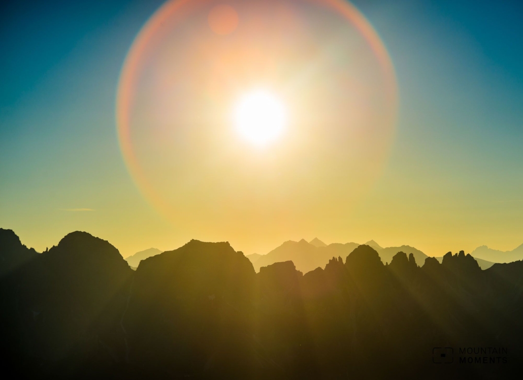
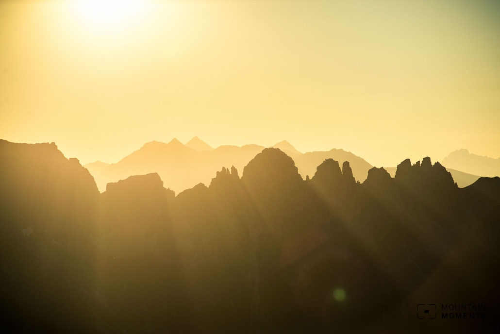
The small summit plateau catches the first sun rays of the day. To have experienced a sunrise here once is a must for every Innsbruck mountain lover. On a warm weekend day you are not alone, but you save the sweaty climb during the day in the blazing sun
Directions! This is how your Serles hiking adventure looks like on a map
For a sunrise tour by car to Maria Waldrast (toll road). Directly in front of the small chapel take the hiking trail towards Serles steeply uphill.
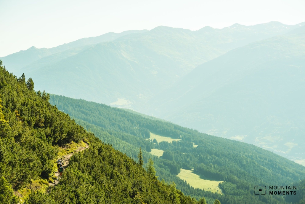
Follow the hiking trail first steeply through the forest, then flatter through a mountain pine slope and finally again steeply into an alpine high valley to the Serlesjöchl. Here turn right and follow the mountain trail over two difficult, but secured steep steps over gravelly terrain, partly steep, to the summit. Descent as ascent. For the sunrise, it is recommended to start about three hours before sunrise at the parking lot.
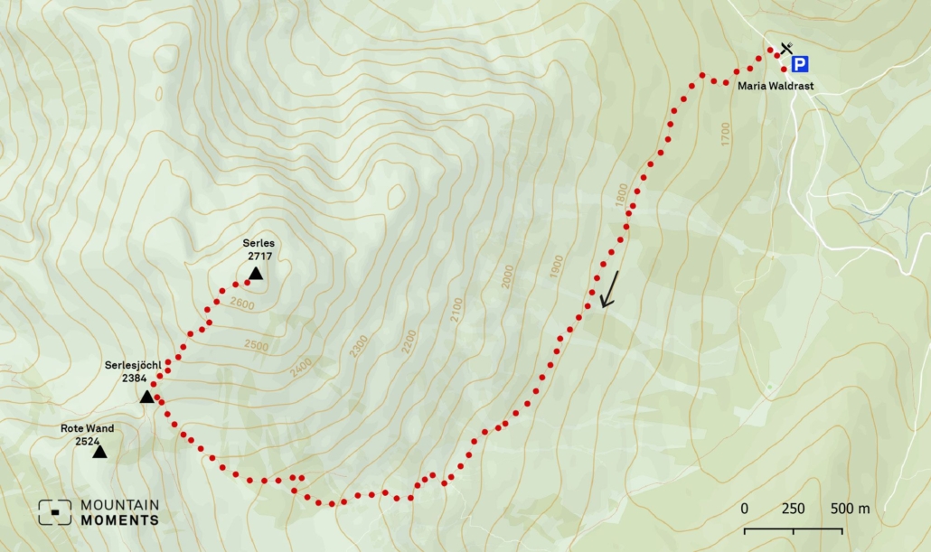
Photo tips that will make your Instagram pop – the summit from Serles
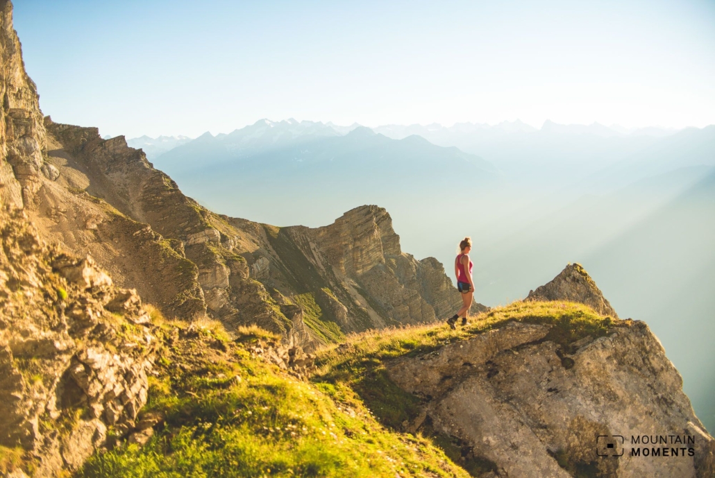
The summit view from the Serles is probably unsurpassable. With an ultra-wide-angle lens, the deep views can be captured especially well.
From a photographic point of view, a Serles ascent also includes photographing the mountain in its most beautiful splendor from Innsbruck. The panorama terrace at the Hungerburg is ideal for this.
More information about Serles Hike
How to get there by car: From Innsbruck by Brenner freeway (toll) to Matrei am Brenner. At the entrance to the town, turn right and climb steeply uphill towards Maria Waldrast and take the toll road to the parking lot at the monastery.
How to get there by public transport: From Innsbruck with Regiobus 590 (main station Steig A) to station Mieders – Serlesbahn about 30 minutes. Continue with the Serles cable car.
Difficulty level: difficult
Duration/distance: 5h,/10 km
Ascent/descent: 1100m/1100m
Highest/lowest point: 2770m/1635m
Refreshment stop: Serles mountain station, Maria Waldrast
Start/finish: Mieders Serlesbahn valley station (coordinates: geogr. 47.163808, 11.379690)
The best Summer Adventures in and around Innsbruck – Hiking, Mountainbiking, Trekking, Climbing and more

Fancy more Summer Adventures in Tyrol and around Innsbruck? We got you covered! The best outdoor sports activities for Summer Enthusiasts as eBook: Innsbruck Summer Outdoor Guide.
Here we have compiled the most beautiful locations and photo opportunities. 30 activities with numerous photo spots are selected and described in such a way that you can easily experience these wonderful adventures around Innsbruck for yourself – including track infos, and maps and all other information that you need.
You can take a closer look at the Innsbruck travel guide ebook here – why not share it with your adventure partner?

Hi, i am Marius, i love exploring the mountains and nature. Friends say, i know the mountains better than most locals, but actually i get lost all the time while photographing ;). Read more about the Mountain Moments Team.


