Zugspitze Hiking Map! Photography Workshop on Germany’s Highest Mountain
Zugspitze, the highest peak of Germany lies in the Wetterstein Mountains. It reaches alomst the 3000m mark and is reachable only for experienced hikers on foot (if you dont want to take the lift all the way up. This hiking route is not easy, and here on Mountain Moments, we point out all the circumstances that make it challenging and intriguing as well.
If you love hiking routes like these, look no further, because we give you a map, detailed trail description, photography tips and tricks – and an invitation to join us on our next Alpine adventure.
What’s so special about this hiking route and why you should join us?
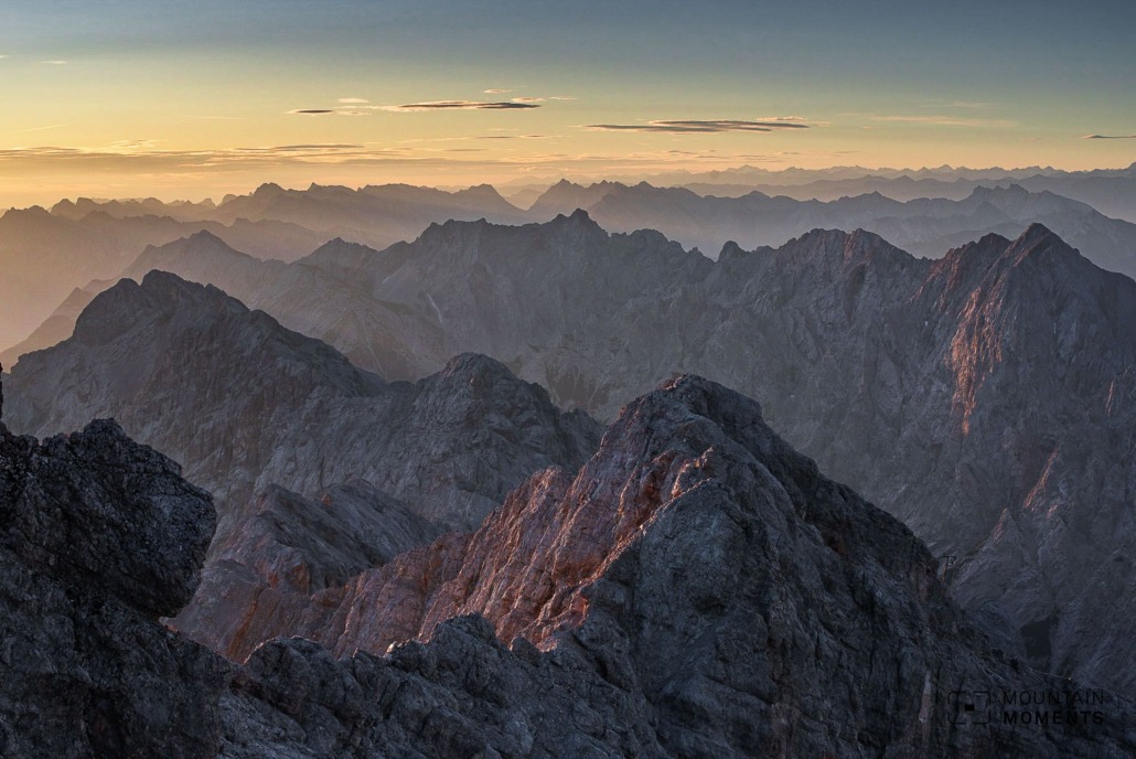
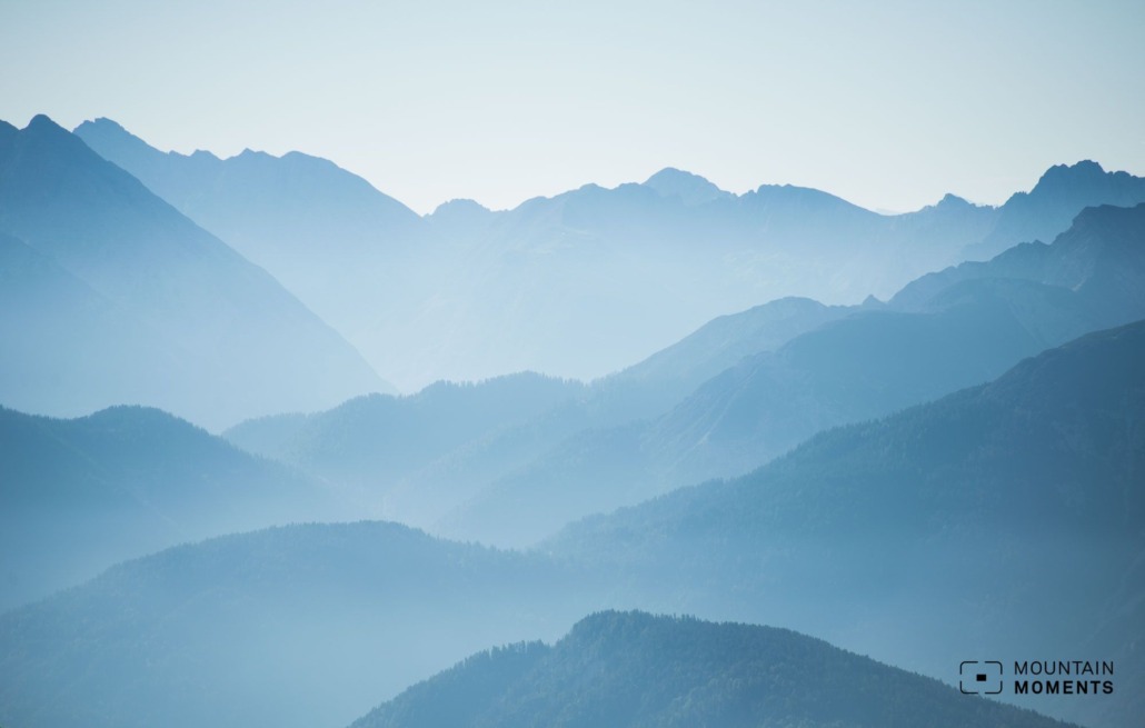
Germany’s highest mountain – the Zugspitze – is truly impressive. It rises almost out of nowhere from the southern Bavarian plain at almost 3000 meters – it is only 38 meters short of this magical mark.
Of all the steep and difficult climbs, the way over the Gatterl is the only tour that doesn’t really require arm use. If you want to make your mountaineering dreams come true, you should take a closer look at the climbs around the Schneekar and Höttental.
Directions! This is how your Zugspitze trip looks like on a map
The circular tour over the Gatterl to the Zugspitze requires some logistical planning. The best way to start by car or bus is from the Ehrwalder Almbahn.
The hike starts at the Ehrwalder Almbahn mountain station (1500m). A road leads towards Gatterl, past the plague chapel on the left and now uphill on the Max-Klotz-Steig at the Hochfeldern Alm over Alpine pastures to the Brandjoch (2120m).
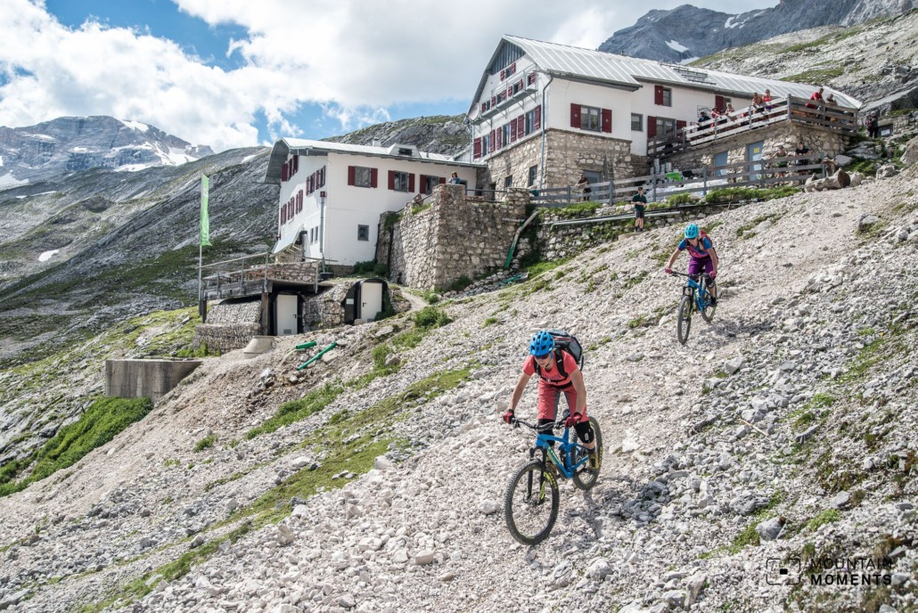
We follow the trail to the Feldernjöchl (2041 m). Now turn left to the Steinernen Hüttl and briefly uphill to the Gatterl (2040m) with rope insurance. We continue to the Knorr Hütte. Here, on the left, steep and gravelly uphill, master the final ascent to the Zugspitzplatt (2580m).
Alternatives
There are many other ways to the Zugspitze. The routes via Schneekar and Höttentalsteig are the two easiest: they are insured as a via Ferrata. Other mountain tours such as the one over the Jubilee ridge or the Höllentalspitzen are reserved for alpinists.
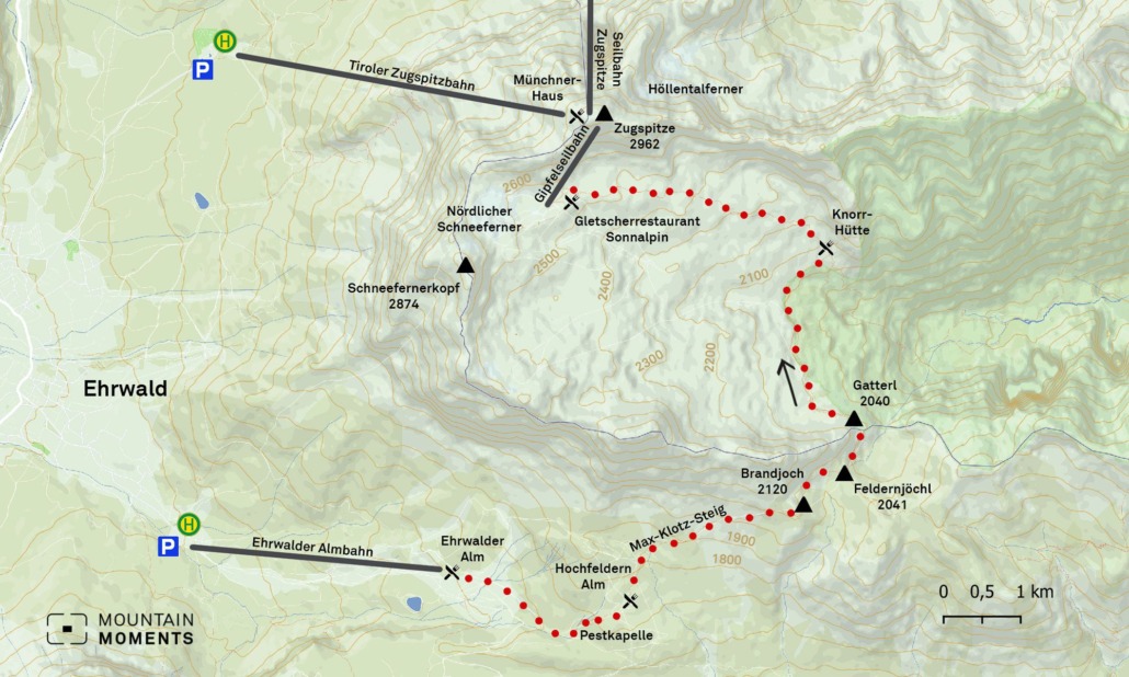
Photo tips that will make your Instagram pop! Alpine valleys, grassy slopes and hiking trails
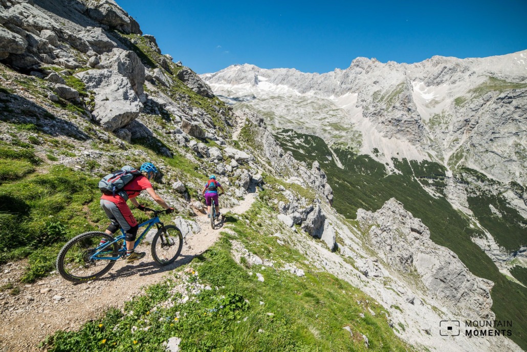
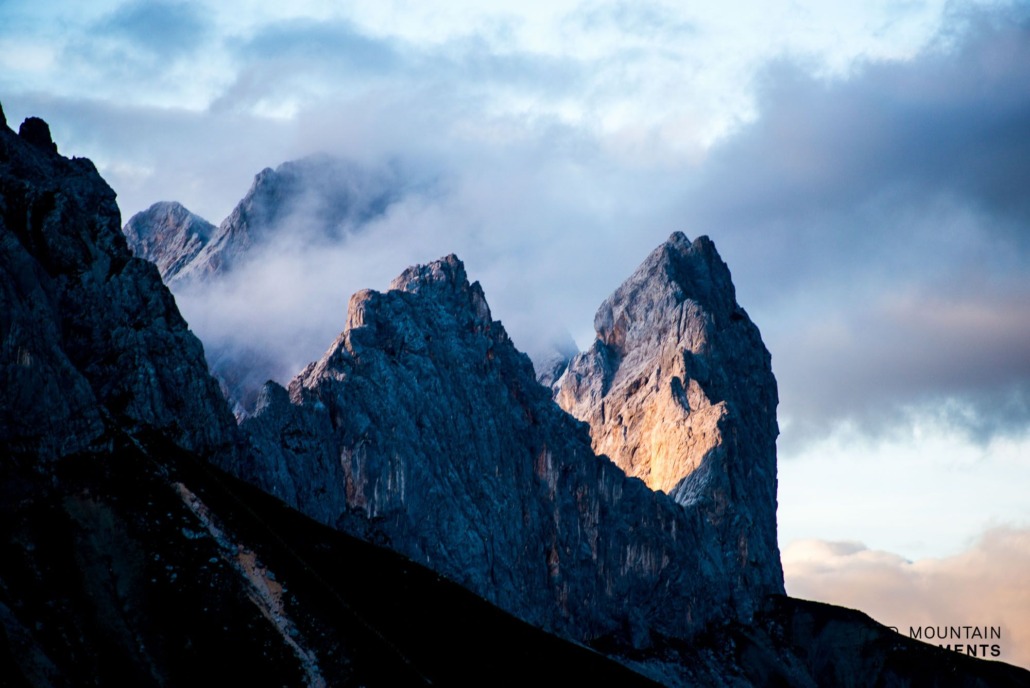
The hike over the Gatterl is varied, as you walk through two Alpine valleys on this tour. In particular, the region in front of and around the Gatterl is the most photogenic thanks to its unique seclusion. This is where steep grassy slopes and glacier-polished rock formations alternate.
Tip: Include the alpine hiking trail in the pictures as a visual element.
Mountain Moments Photo Workshops provide Photo Tours for everybody, Alpine Experience for beginners and intermediate-level photographers with 3 to 6-hour routes, as well as Summit Experience for more advanced photographers and hikers. We have private workshops and group classes.
More important information! From arrival to the finish line
Arrival: A95 and B2 to Garmisch-Partenkirchen. Via the B187 to Ehrwald and the Ehrwalder Almbahn (car park). Back to the starting point by bus line 3.
Public transportation: By train to Garmisch-Partenkirchen. Change to Ehrwald. On foot (approx. 45 minutes) or by bus to the Ehrwalder Almbahn by bus line 3.
Difficulty: medium – difficult
Duration: 7h
Distance: 14km
Ascent/descent: 1270m/195m
Highest/lowest point: 2962m/1500m
Refreshments available: Ehrwalder Alm, Hochfeldern Alm, Knorr Hütte, Zugspitzplatt glacier restaurant, Münchner Haus, Zugspitze summit restaurant
Start finish: Start: Ehrwalder Almbahn mountain station (coordinates: geogr. 47.385316, 10.968379)/Tiroler Zugspitzbahn
Particular dangers: Sure-footedness and a head for heights are required for the ascent to the Zugspitz summit. Via Ferrata set is recommended.
Tips: Gatterl tour ticket available from the mountain railways. Sunset rides on the Tiroler Zugspitzbahn are a special experience.
The most beautiful photo spots and hikes in the German Alps – experience this hiking tour and 29 other exceptional regions now.

Fancy more hikes in the mountains – and beautiful photos? Get out into nature! Experience the best hikes and locations with our new book: German Alps – Photo and Hiking Guide. The 90 best Photo Locations and 30 most panoramic Hikes.
Here we have compiled the most beautiful locations and photo opportunities. 30 hikes with 90 photo spots are selected and described in such a way that you can easily experience these wonderful landscapes in Bavaria for yourself – including GPS tracks and hiking map and all other information.
You can take a closer look at the ebook here– – why not share it with your hiking partner in crime?

Hi, i am Marius, i love exploring the mountains and nature. Friends say, i know the mountains better than most locals, but actually i get lost all the time while photographing ;). Read more about the Mountain Moments Team.


