Hiking on Hoher Ifen in Kleinwalsertal! Photograph Unique Sights Above Gottesacker
In the Allgäu Alps, west of the Kleinwalsertal valley and between Germany and Austria, A truly unique landscape awaits you. With the help of Mountain Moments, you can explore and photograph the hidden foothills of the German Alps.
In the idyllic Kleinwalsertal, an Austrian enclave that can only be reached via German roads, the Hoher Ifen is probably the most striking mountain shape in the Allgäu Alps.
What can you expect on this hiking route in the Allgäu Alps?
In the south and west, the elongated rock is surrounded by wide, sometimes very steep grass meadows. In the north, a kilometer-wide karst area (Gottesacker) is located in front of the Hoher Ifen.
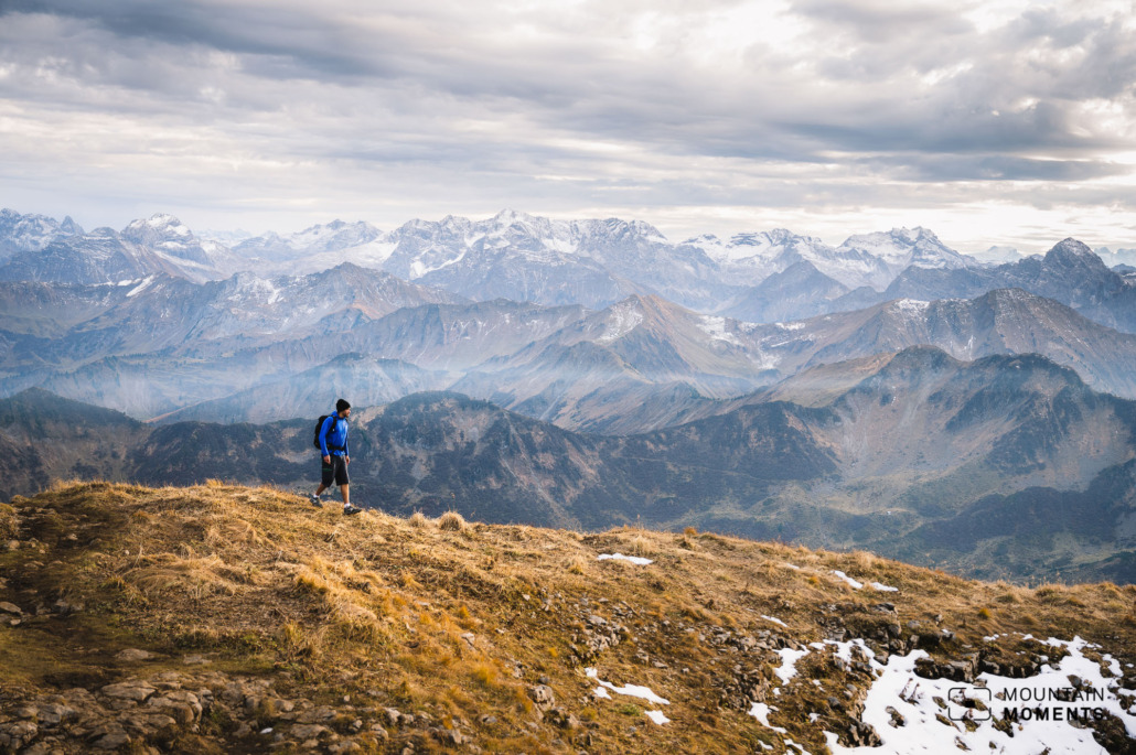
With the mountain railway, the ascent to the Hoher Ifen is quite short. The imposing mountain attracts mountaineers in droves, despite steep steps in the Ifenmauer. After all, the unique, vertical view that we experience from there is breathtakingly beautiful.
Directions! This is how you Hoher Ifen trip looks like on a map
The start of this tour is the parking lot of the Ifen ski area (Auenhütte, 960m). Behind the mountain station in the direction of Hoher Ifen, briefly follow the road uphill. We go up the hiking trail to the left to the Ifen hut (middle station, 1590m). Continue up the well-marked path to the Ifenbord, follow the signpost to the left into the Ifenmulde.
Here it gets steeper through a scree slope to the Ifenmauer. The last meters here are steep, stepped, somewhat exposed, and secured with ropes.
Attention! In spring/early summer there can still be dangerous snowfields in the rock wall. On the plateau, the path now climbs logically and quite easily to the summit (2230m).
Refreshment stops on this exciting hiking route are Auen Hütte, Ifen Hütte, Alpe Ifersgunt, Alpe Melköde and Schwarzwasser Hütte.
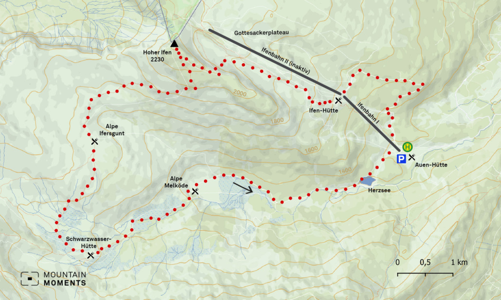
The descent takes place via the Ifersguntalpe and Schwarzwasserhütte (1615m) with several short secured passages and over scree fields. After the alp, the path becomes easier.
Attention again! The danger of slipping on damp, loamy areas! From the Schwarzwasser hut, we enjoy the beautiful hiking trail that logically follows the course of the valley – and finally, we reach the Auenhütte.
The scree fields, the steep ascent to the Ifen plateau, and the long descent via Ifersgunt, Schwarzwasserhütte, and Melköde require good physical condition, sure-footedness, and a head for heights. For experienced tourers, however, this ascent is a pleasant mountain tour.
Photo tips that will make your Instagram pop! Beautiful views from the Walmendinger Horn
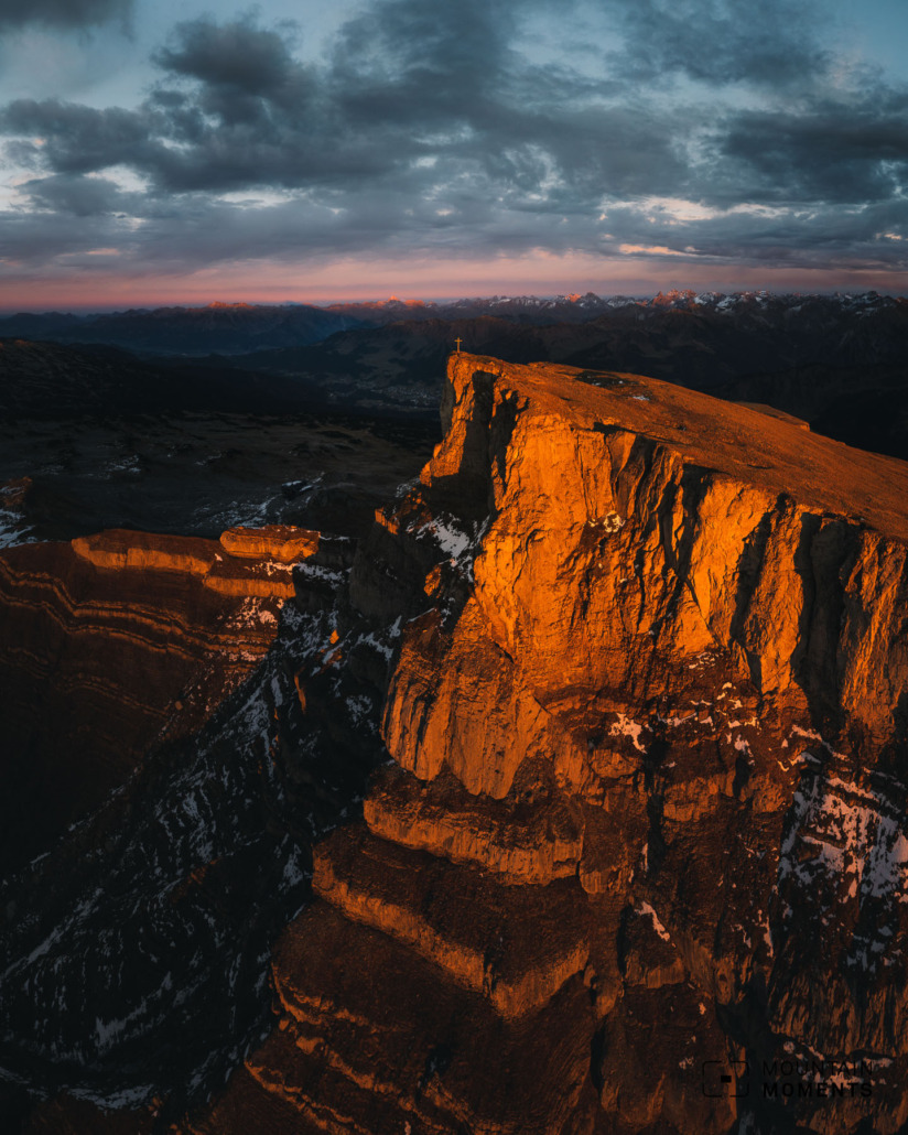
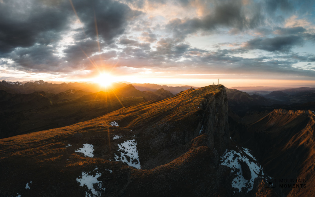
The Hoher Ifen benefits from its striking shape and its exposed location – it towers quite a bit over the surrounding peaks. With a bit of courage and fortunate positioning, the steep walls can be highlighted in a photo.
Mountain Moments Photo Workshops provide Photo Tours for everybody, Alpine Experience for beginners and intermediate-level photographers with 3 to 6-hour routes, as well as Summit Experience for more advanced photographers and hikers. We have private workshops and group classes.
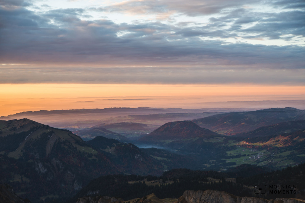
But even without the risk of falling, the generally typical Allgäu mountain landscape with the steep grassy areas is an interesting photo motif. At sunset, with a bit of luck, you can catch an interesting play of colors (don’t forget your headlamp!).
We have the best view of the Hoher Ifen from the Walmendinger Horn. This is the best place to see the unique summit plateau with its vertical rock walls. Alternatively, there are attractive, picturesque stone landscapes with interesting karst forms on the Gottesacker plateau.
More information about your adventure in the Allgäu Alps – from arrival to the finish line
Getting there: A7 exit Kempten onto the B19 in the direction of Oberstdorf. Shortly before entering the town, stay right on the B19 in the direction of Kleinwalsertal (AT). After Riezlern, turn right in the direction of the Ifen mountain railway and follow to the car park (subject to a charge).
Public transport: By train to Oberstdorf, change to the Walserbus 1 to Riezlern (post or municipal office stop). Change to bus 5 in the direction of Ifen to the final stop (Ifen Auen-Hütte).
Difficulty: medium – difficult
Duration: 6 hours, 14.5 km
Ascent/descent: 960hm/960hm
Highest/lowest point: 2230m/1274m
Rest stops: Auen Hütte, Ifen Hütte, Alpe Ifersgunt, Alpe Melköde, Schwarzwasser Hütte
Start/finish: Hirschegg car park/stop Ifenbahn (coordinates: geogr. 47.342690, 10.137000)
Special dangers: In the Ifenmauer high rocky escarpment with two short passages secured with ropes. Sure-footedness and a head for heights are required.
Tips: Capture the sunrise in summer with your camera.
The most beautiful photo spots and hikes in the German Alps – experience this hiking tour and 29 other exceptional regions now.

Fancy more hikes in the mountains – and beautiful photos? Get out into nature! Experience the best hikes and locations with our new book: German Alps – Photo and Hiking Guide. The 90 best Photo Locations and 30 most panoramic Hikes.
Here we have compiled the most beautiful locations and photo opportunities. 30 hikes with 90 photo spots are selected and described in such a way that you can easily experience these wonderful landscapes in Bavaria for yourself – including GPS tracks and hiking map and all other information.
You can take a closer look at the ebook here– – why not give it as a

Hi, i am Marius, i love exploring the mountains and nature. Friends say, i know the mountains better than most locals, but actually i get lost all the time while photographing ;). Read more about the Mountain Moments Team.


